How LiDAR and Camera Sensor Fusion Advances Autonomous Driving
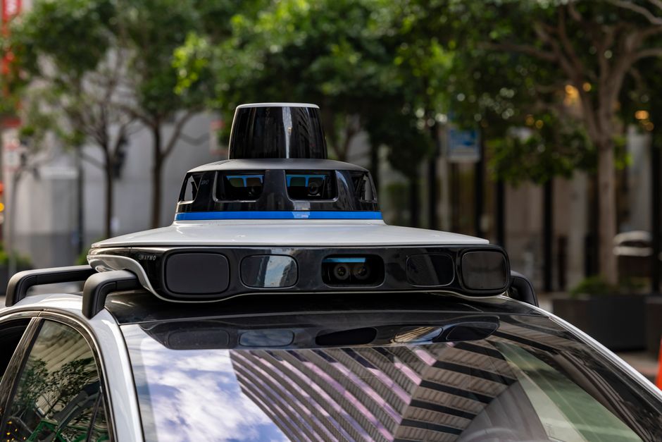
Autonomous driving systems rely on a complex interplay of sensors to perceive and interpret the surrounding environment. Among these, LiDAR and cameras are two of the most prominent, each offering distinct strengths and limitations. LiDAR provides precise 3D distance measurements using laser pulses, while cameras deliver rich visual information, including color and texture. The combination of these modalities through sensor fusion has become a cornerstone of modern autonomous vehicle perception systems. This article examines how LiDAR and camera fusion enhances object detection and reliability, exploring the underlying principles, methodologies, and considerations that shape its implementation.
The process of sensor fusion goes beyond simply aggregating data; it involves integrating information from multiple sources to create a unified and consistent representation of the world. This integration enables autonomous systems to leverage the complementary characteristics of LiDAR and cameras, potentially mitigating the weaknesses of each individual sensor. By aligning and combining these data streams, perception algorithms can achieve a more robust and accurate understanding of the driving scenario, which is critical for safe and efficient navigation. This article provides an informational overview of the techniques and concepts involved in LiDAR-camera fusion, focusing on their role in advancing autonomous driving capabilities.
Understanding the Complementary Nature of LiDAR and Cameras
LiDAR sensors emit laser beams and measure the time it takes for the light to return, generating a dense point cloud that maps the distances to surrounding objects. This provides highly accurate 3D spatial information, making it particularly effective for measuring the precise location, size, and shape of obstacles. Cameras, on the other hand, capture light in the visible spectrum, producing images that are rich in semantic content such as colors, textures, and text. This visual information is essential for tasks like recognizing traffic signs, lane markings, and other critical elements that are difficult to infer from point clouds alone.
Despite their respective strengths, both sensor types have inherent limitations. LiDAR can be affected by adverse weather conditions, such as heavy rain or fog, and typically provides sparse data at long ranges. Cameras are sensitive to lighting variations, including glare and shadows, and struggle with depth perception, especially at high speeds or in low-contrast situations. Sensor fusion addresses these challenges by combining the strengths of each: LiDAR ensures geometric accuracy and robustness to lighting changes, while cameras contribute dense semantic information and the ability to read textual cues. This complementary relationship forms the foundation for improved object detection, as the fused data allows the system to cross-validate and enhance the interpretation of the environment.
The fusion of LiDAR and camera data also aids in handling dynamic scenes where objects move and change appearance. For instance, a camera may identify a vehicle by its color and shape, while LiDAR accurately tracks its position and velocity. By integrating these data, the perception system can maintain a consistent and reliable object trajectory even when one sensor is temporarily occluded or noisy. This redundancy is vital for ensuring that the vehicle’s understanding of its surroundings remains stable, thereby contributing to the overall reliability of the autonomous driving system.
Technical Approaches to LiDAR-Camera Fusion
Sensor fusion can be performed at various stages of the perception pipeline, each with distinct advantages and trade-offs. Early fusion, also known as data-level fusion, involves combining raw sensor data before processing. For LiDAR and cameras, this requires precise calibration to align the 3D point cloud with the 2D image pixels. The aligned data is then used to generate a richer input representation, such as a colored point cloud or a multi-channel image, which can be processed by subsequent algorithms. This approach preserves detailed information from both modalities but demands accurate spatial synchronization and can lead to high computational costs.
Late fusion, or decision-level fusion, processes each sensor stream independently to generate separate object detections or classifications, which are then combined using algorithms like weighted voting, bayesian inference, or logical rules. This method is simpler to implement and more modular, but it may fail to exploit the complementary information fully, as decisions are made separately and conflicts are resolved at a higher level. A middle ground is feature-level fusion, where features extracted from each sensor are concatenated or integrated within a machine learning model, such as a neural network. This approach allows the model to learn which features are most useful, often leading to better performance than early or late fusion.
In modern autonomous driving systems, deep learning models frequently employ fusion at intermediate layers, allowing the network to combine spatial and semantic features adaptively. For instance, the point cloud can be projected onto the image plane and combined with image features using convolutional layers, enabling the model to leverage both geometric and textural cues. Some approaches use attention mechanisms to weight the importance of each modality depending on the context, which helps the system focus on the most reliable information at any given moment. These advanced techniques have shown promise in improving detection accuracy and robustness across various driving scenarios.
Improving Object Detection Accuracy and Reliability
The primary advantage of LiDAR-camera fusion is enhanced object detection. Cameras can successfully identify objects based on appearance, but depth information is often ambiguous. LiDAR fills this gap by providing precise range data, allowing the system to determine the distance and size of detected objects more accurately. For example, a camera might recognize a pedestrian, but LiDAR can confirm their exact location and speed, reducing the risk of false positives. Conversely, LiDAR can detect objects that are difficult for cameras to see, such as in dark conditions or when the object has low contrast, and the camera can provide semantic labels to classify those objects, such as distinguishing between a pedestrian and a tree.
Reliability improves through redundancy and consistency checks. When both sensors agree on an object’s presence and properties, the confidence in that detection increases significantly. Discrepancies between sensor readings can be flagged and handled with more cautious behavior, such as reduced speed or alerting the control system. This approach contributes to a more predictable and trustworthy perception system, which is crucial for public acceptance and regulatory compliance. Furthermore, fusion can help in scenarios where one sensor degrades, as the other can often compensate, ensuring that the perception system maintains a certain level of performance even under partial failure.
The integration of temporal data also enhances reliability. By aligning LiDAR and camera streams over time, the system can track objects more consistently, even when they are temporarily occluded. Motion prediction becomes more accurate when both visual and geometric data are considered, which is essential for safe trajectory planning. Overall, the fused perception model provides a more complete and robust representation of the environment, leading to better decisions by the autonomous driving system.
Challenges and Considerations in Sensor Fusion
Implementing LiDAR-camera fusion is not without its challenges. Calibration is a major concern, as any misalignment between the LiDAR and camera coordinate frames can lead to erroneous fusion results. This requires precise extrinsic calibration (relative positions and orientations) and intrinsic calibration (camera lens properties), which must be maintained over time as the vehicle experiences vibrations and temperature changes. Good calibration ensures that data from each sensor are correctly overlaid, forming the foundation for effective fusion.
Another challenge is handling different data resolutions and field of view mismatches. LiDAR typically has a narrower vertical field of view compared to cameras, and its point density decreases with distance. Sensor fusion algorithms must account for these variations, perhaps by using upsampling or interpolation techniques to align the data. Additionally, real-time processing constraints demand efficient implementation, as fused data can be voluminous and processing must occur within strict time windows for safety-critical applications. Optimizing computational resources is therefore a key consideration.
Weather and environmental conditions also pose difficulties. Fusing data in rain, fog, or snow is still an area of active research, as both sensors can degrade under such conditions. Some systems incorporate weather-detection modules to adjust sensor priorities accordingly, but this adds complexity. Moreover, the cost of LiDAR units has historically been high, although it is decreasing, making fusion economically viable for mass-produced vehicles. These technical and economic factors influence the adoption of sensor fusion and continue to drive innovation in the field.
Sensor fusion should be understood as a method to leverage complementary information, not as a guarantee of perfect perception. The effectiveness of fusion depends on the correct integration of data and the context in which it is applied.
Enhancing Semantic Understanding and Contextual Awareness
Beyond object detection, LiDAR-camera fusion significantly enriches semantic understanding of the environment. Cameras provide high-resolution semantic information, such as recognizing road signs, traffic lights, and lane markings. LiDAR adds spatial context, allowing the system to understand the layout of the scene, including drivable areas and obstacles. By fusing both, autonomous vehicles can better interpret complex scenarios, such as intersections with mixed traffic or construction zones, where contextual cues are vital for safe navigation.
Contextual awareness also benefits from the ability to analyze dynamic scenes. For instance, camera images can show a pedestrian’s intent through body language, while LiDAR tracks their precise movement. Combining these cues helps the system predict potential actions, such as a pedestrian about to cross the road. This predictive capability is essential for proactive decision-making, which is a step beyond reactive responses. In a similar vein, understanding the type of road, whether it is a highway or a narrow street, can be enhanced by the geometric layout provided by LiDAR, while cameras identify relevant signs and markings. This holistic view contributes to a more nuanced and reliable situational awareness.
Moreover, fusion supports the development of high-definition maps, which are crucial for autonomous navigation. LiDAR point clouds are used to create precise 3D maps, while camera images can annotate these maps with semantic labels. The integration of both data types facilitates the creation of richer maps that are updated in real-time, ensuring the vehicle has the most current information. This continuous map updating is particularly important for adapting to road changes, such as new constructions or temporary diversions, thereby enhancing the overall safety and efficiency of the autonomous system.
Evaluating Fusion Performance and Future Directions
To assess the effectiveness of LiDAR-camera fusion, researchers and developers rely on a range of metrics, including detection accuracy, precision, recall, and processing speed. Standardized datasets, such as KITTI and nuScenes, provide benchmarks for comparing different fusion methods. These evaluations reveal that, in general, fusion approaches outperform single-sensor methods, particularly in challenging conditions like low light or occlusion. However, the degree of improvement varies depending on the algorithm and the specific driving scenario, underscoring the need for thorough testing and validation.
The future of sensor fusion in autonomous driving is likely to see increased integration with other sensors, such as radar and ultrasonic sensors, to create a more redundant and robust perception system. Additionally, the use of artificial intelligence and machine learning will continue to evolve, with novel architectures that learn to fuse data in more efficient and adaptive ways. Another trend is the development of solid-state LiDAR, which is more compact and cost-effective, potentially accelerating the adoption of fusion technology in commercial vehicles. As the field progresses, the principles of transparency and methodological rigor remain essential, ensuring that these systems are safe and reliable before widespread deployment.
In summary, LiDAR and camera sensor fusion plays a pivotal role in advancing autonomous driving by improving object detection and reliability. Through the integration of complementary data, fusion enables a more complete and accurate perception of the environment, which is fundamental to safe and efficient operation. While challenges exist, ongoing research and technological advancements continue to refine these methods, promising to enhance the capabilities of self-driving systems.